
Sources for Montgomery Previous Residents
The date of interest determines which source should lead. Current appraisal data points to today's owner and recorded deed. The Probate computer index then carries the chain back to its digital cutoff. Directories and census schedules add listed occupants and full households for selected years. Older deeds, estate files, maps, and city files bridge the years that have no online address index.
| Source | Years it covers | Where held | What it shows |
|---|---|---|---|
| Computer land index | June 1970 to present | Montgomery County Probate online and Records Room | Ownership instruments, liens, dates, book and page |
| Earlier deed books | Before June 1970 | Probate books, public terminals and microfilm | Transfers and legal descriptions |
| City directories | Verified surviving run from 1859-60 through July 2007, with gaps | ADAH and Montgomery Room | Listed adults, address, and sometimes occupation |
| Cross-reference directories | About 1982-2008 | County Archives and ADAH | Listed occupant by street and house number |
| Federal census | Released through 1950 | NARA and research databases | Household members and nearby households |
| Estate files | Montgomery index spans the 1820s-1940s | Alabama Department of Archives and History | Decedent, heirs, representatives, and property clues |
| Permit and city files | Online start not verified | City records request | Alterations, certificates, code, zoning, or applicants |
Start with the newest source that gives a firm parcel identity, then work toward the target year. The June 1970 line is a computer-index boundary, not the beginning of the county's deeds. Likewise, a gap between directory editions is a publication gap, not proof that the address was empty.
Start Montgomery Previous-Resident History
Search the Revenue Commissioner Citizen Access Portal by address. Copy the exact owner name, parcel or account key, physical situs address, legal description, map clue, and any deed reference. The situs is the land's physical location. The mailing address is where tax contact goes. A difference between them is useful evidence, but it does not prove where the owner resides.
Next, open the county parcel viewer from Appraisal Online Services. Confirm that the mapped boundary matches the address and note nearby roads, lot lines, and identifiers. County online services also link aerial photography and Land & Lot Book Archives. Those books can bridge a modern parcel to older assessment geography when a street or deed search stalls.
Keep a dated research log. Record each spelling, parcel key, deed book and page, and legal description exactly. The current owner's parcel card is only the opening lead in a previous-residents search. It does not name prior occupants or all people living there now.
Note: A homestead or exemption marker may support owner occupancy for its tax year, but it is not conclusive household evidence.
Trace Montgomery Past Owners Backward
The Probate Records & Recording Division is the main ownership trail. Its computer index begins in June 1970. Search the current acquisition instrument, then use each seller's name to locate the seller's own earlier acquisition. Dates, legal descriptions, and prior-instrument references keep the chain on the same tract when names repeat.
- Pull today's owner, legal description, and deed clue from the parcel card.
- Find that owner's acquisition deed. Copy the grantor, grantee, indexed date, book, page, legal description, and prior reference.
- Search the seller as an earlier grantee. Use a date range and check name variants, initials, and suffixes.
- Repeat the transfer link until the chain reaches the June 1970 computer-index boundary.
- Continue at the Records Room through terminals, deed books, microfilm, and its grantor-grantee tools.
- Grantor
- The person or entity transferring an interest in the recorded instrument.
- Grantee
- The person or entity receiving that interest.
- Chain of title
- The linked series of recorded transfers for the same tract.
- Legal description
- The lot, block, subdivision, or metes-and-bounds language that identifies the land beyond its street label.
Probate directs name searches to last name then first name without a comma. Its documented percent-sign wildcard can catch fragments and possible indexing differences. Expanding a party exposes instrument rows; a known book and page provides a second route. Check both sides of each conveyance rather than relying on one exact spelling.
Montgomery Previous-Resident Digital Divide
The free land index and the document image are not the same product. Index users can identify a record, but online images require a $10 monthly account and cost $0.25 when printed through the web service. The Probate Records Room in the basement of Courthouse Annex III provides public computers, deed-book images from book 400 forward, microfilm, and staff or County Archivist help. Counter copies cost $1 per page, plus $2 for certification.
Book 400 is a verified book boundary, not a known calendar-year equivalent. Do not convert it into a date. When the online chain stops, take the last book and page, grantor, grantee, and legal description to the Records Room. Older material may then be followed in the physical or filmed grantor-grantee apparatus.
Access tip. Public Records Room terminals can bridge the gap between a free online index and a paid remote image.
Montgomery County began in 1816, long before the digital index. Early searches may also need the terms Alabama Town, East Alabama, New Philadelphia, or a later county name created from the wider original county. A family may have remained on the same land while the jurisdiction used in an index changed.
Separate Montgomery Occupants From Owners
A deed grantee is an owner in a recorded transaction. A directory entry is a listed occupant at publication time. Their mismatch can point to a leased home, an estate, an owner living elsewhere, or a lag between a move and publication. It is not an error by itself. This comparison is central to finding previous residents because many occupants never appear in a deed chain.
Use a reverse directory by street and house number when one exists. Montgomery County Archives identifies cross-reference volumes from about 1982 through 2008. ADAH holdings include the Greater Montgomery, Prattville, and Wetumpka Cross Reference Directory for 1993-97 and later Montgomery cross-reference editions through July 2007. The Montgomery city directory collections are documented separately; the backward address trail needs only the relevant dated entry and its source.
Older alphabetical entries may express a home as a corner, between two streets, near a landmark, or opposite another place. Read the abbreviation key. Copy the entry image rather than trusting weak OCR. Search the street guide, householder section, and the named person's entry when available.
Pair Montgomery Residents With Census
Directories provide a snapshot between federal census years. The 1940 and 1950 censuses are released, so a directory from the same period can help locate the right household and block. A census schedule may add family members and nearby households that the directory did not list. It still must be matched by name, address context, age, and relationships rather than surname alone.
- Establish the exact street spelling and number used in the directory year.
- Copy the listed occupant, occupation or other identity clue, and nearby address entries.
- Find the household in the released census by name and place, then compare neighbors and address context.
- Check the next directory edition to test continuity before and after the census year.
- Use deeds, probate, certificates, or newspapers to verify an ownership, death, or heir conclusion.
This process can recover past residents who never owned the parcel. Publication gaps, spelling errors, and changing house numbers remain possible. No official countywide street-renumbering year was found, so resolve a suspected number change through dated maps, plats, directories, County Archives cadastral maps, and Land & Lot books rather than inventing one.
Note: Federal census schedules show people at an enumeration date; they do not prove continuous residence for the whole decade.
Montgomery Estate Files for Past Residents
An ownership or directory trail can end when a person dies, an estate conveys the property, or heirs take part in a later deed. The ADAH Montgomery County Estate Files Index spans the 1820s through the 1940s. Search fields are Name and Keyword(s). After a hit, the County Records on Microfilm database helps locate the underlying item.
The official estate index is shown below. Its narrow fields make name variants and keywords worth testing, especially when a deed names an estate, personal representative, or heir rather than the former resident in the expected role.
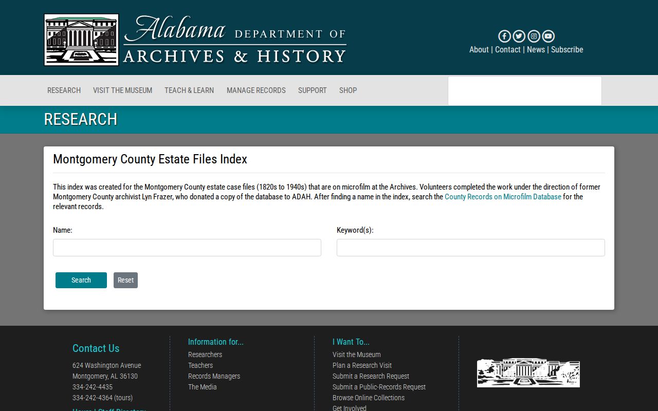
An index hit is a pointer, not the estate packet. The underlying file may name a decedent, representative, heirs, and property. Compare it with will books, death evidence, deeds, and obituaries before closing the identity trail.
ADAH remote research is another access channel. The researched service costs $15 for an Alabama resident or $25 for an out-of-state requester, covers one surname and up to four sources, includes 20 copies, and usually takes two to three weeks. The Research Room, county microfilm, and Ask an Archivist route remain useful when the question is too complex for the online index.
Map Montgomery Past-Resident Addresses
Sanborn fire-insurance maps can show a building footprint, construction clues, use, and street-number context. The research confirmed Montgomery sheets in Library of Congress, ADAH, or library collections, but not a complete authoritative year list. Search the Library of Congress Sanborn collection, then ask local staff to verify the exact sheet and date needed.
County Archives cadastral maps and equity tax dockets can bridge an old intersection to a modern parcel. The legal description is often the best thread when a road name or number does not match. One verified name change is West Jefferson Davis Avenue to Fred D. Gray Avenue in October 2021. Search records on both sides of that date under the proper contemporary name.
City permits, certificates of occupancy, inspections, code, zoning, and variance files can date changes to a property. The City has no verified open historical permit-name browser, so use its public-record process with a full physical address and a precise category. Since April 7, 2025, the listed charge is $25 per address and report for several common property categories, including a certificate of occupancy, code violation, inspection, zoning, variance, or special-exception report.
Montgomery Archives Add Resident Context
ADAH vertical files contain clippings, correspondence, sketches, programs, and pamphlets gathered by topic. Montgomery is especially well represented because the state repository is in the capital. These files can add context to a property, road, institution, or past resident after the deed and directory trail has established identity.
The ADAH vertical-files page introduces the collection shown below. Search county and subject headings, then verify any biographical or address claim against a deed, directory image, certificate, census schedule, or estate file.
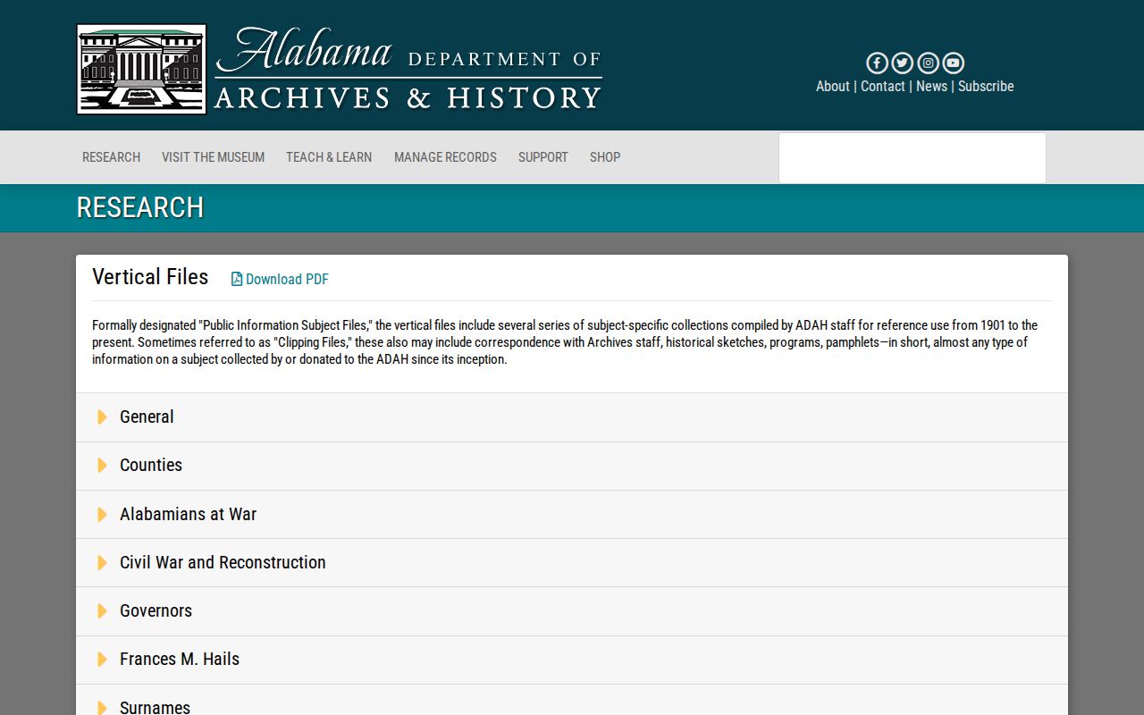
The screenshot shows the archive's subject-file entry point. It is a context collection rather than a complete name or address directory, so its best role comes late in the workflow.
Montgomery Room vertical files, yearbooks, microforms, and newspapers can add classmates, institutions, announcements, and former address clues. Church and synagogue catalogs may help with a known congregation, though donor and congregation rules vary. Obituaries can identify relatives and former places, but pair them with an official or archival record before treating them as final proof.
Use Montgomery Resident History Lawfully
Previous-resident research works best for family history, parcel history, heirs, preservation, and personal curiosity. It should preserve the difference between public facts and private life. Protected voter addresses, DMV data, utility accounts, juvenile matters, sealed records, and adoption files do not become open because a historic address is known.
Lawful use. Use Montgomery County address history for legitimate personal research. Never use a past or current address to stalk, threaten, harass, or evade privacy protections.
Record the date and custodian beside each finding. Correct parcel facts with the Revenue Commissioner, recording-index facts with Probate, and archival descriptions with the holding repository. A commercial compilation can merge names or lag a move, so it cannot replace the official deed, dated directory entry, census image, or estate file when identifying previous residents.
Past owners and past residents are related, but they are not interchangeable. When the goal shifts to the current parcel and all lots along its road, the Montgomery County street directory supplies the modern address chain. For a backward search, let each dated source answer only what it was created to record.